Chain of Wetlands
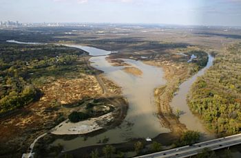
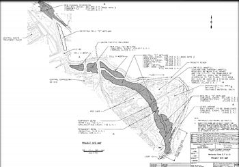
Included as a major part of the Dallas Floodway Extension Project is the development of a series of wetland ponds built to reduce flooding and provide ecosystem restoration. When both the Upper and Lower Chain of Wetlands are complete, the two wetland areas will work together to provide heightened flood protection for Dallas and they will encompass a four mile area from Cedar Creek in the north to Loop 12.

The Lower Chain of Wetlands is a functioning system of four wetland cells. The four ponds located off of I-45 South and Loop 12 East connect and actually flow upstream as they are continuously fed by discharge (or treated water) from the Central Wastewater Treatment Plant (CWWTP). The U.S. Army Corps of Engineers working with the Lewisville Aquatic Ecosystem Research Facility are planting native aquatic vegetation in the area.
The Upper Chain of Wetlands is under design. The three wetland cells comprising this project will be located off of Cedar Crest Bridge. When constructed, they will be connected to the wetlands off of I-45 South.


