Restoring the River Channel
The Dallas Floodway Project is a component of the City of Dallas' Balanced Vision Plan (BVP) which includes raising the existing east and west levees; removing the abandoned AT&SF railroad bridge; constructing a system of floodwater conveyance lakes that would contribute to flood risk management, ecosystem restoration, and recreation. Designs also include implementing a lake recharge system that would provide reuse of treated wastewater discharge for water quality and recreation purposes; creating over 400 acres of new wetlands; providing miles of trails, park roads, and public access points for visitation; constructing athletic playing fields; restoring Trinity River meanders and riparian habitat to replace a previously straightened river channel; and, overall improving interior drainage facilities and capacity.
The Trinity River Corridor has experienced dramatic ecological change over the past century, with the most rapid and extensive changes occurring during the construction of the original Dallas Floodway project in the late-1920s and the U. S. Army Corps of Engineers (USACE) reconstruction of the floodway in the mid-1950s.
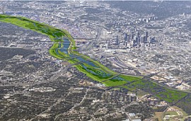
Ecological enhancements to the channel and floodway include restoration of channel meanders and morphologically diverse channel geometry, establishment of a diverse native riparian plant assemblage, and construction of three lakes in the floodway adjacent to the river channel. Given the dynamic nature typical of alluvial systems such as the Trinity River, designing these ecosystem improvements in concert with the aesthetic, recreational, and flood management features of the project has been underway for a number of years.
Several major engineering feats will be part of the project and one of them is the plan to put a semblance of meanders back into the Trinity River as it flows through the downtown corridor. The river was moved from near Houston Street in the late 1920s and the channel was left straight rather than replicating the original meanders. Today, the river will change again. It will be moved slightly to the west of its existing alignment in several places and the meanders will be placed back mimicking its original topography. The benefits of the meanders will be:
- to aid in better floodwater management,
- to deter against bank erosion,
- to foster the natural forces of water flow through the river channel, and
- to slow sentiment transport and deposits.
Always returning to the River
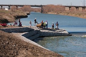
The Trinity River is used for non-motorized boating and outside of Dallas, 25% of rural areas obtain their drinking water from the Trinity River. In general, it is important to preserve rivers and their corridors throughout the world. Hundreds of streams, creeks and water sources feed into the Trinity River as it snakes through the state meeting in Forth Worth and Dallas, a location where the fourth largest metropolitan area in the United States sprawls across its watershed. It is critical because many people depend on its water and so do thousands of species of animals and fish. The river also provides a natural backdrop for wonderful recreational and environmental opportunities.
The Clean Water Act of 1972 passed by the United States Congress and similar laws in other countries have changed the way we treat our rivers, streams and creeks. In the 1960s some rivers were so badly polluted that they actually caught fire and burned.
Today, the Trinity River is monitored on a regular basis by federal and state agencies and Dallas City Departments including: the Texas Commission on Environmental Quality, Environmental Protection Agency, the Trinity Watershed Management's Stormwater Department, and the City of Dallas Water Department. All of these groups meet regularly to review water quality data, implement water quality programs, implement anti-litter and grease campaigns and many other important programs and initiatives.
Throughout the 22 miles of the Dallas Floodway, volunteer and seasonal wetlands welcome flocks of migrating and resident birds, providing them with natural habitat that occurs all along the Trinity River. Small forest animals thrive in the corridor as well as native grasses and plants.
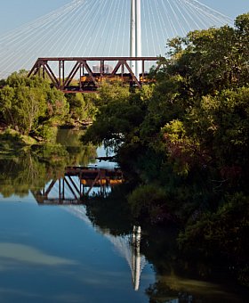
The Trinity River begins at the border of Oklahoma and Texas and meanders all the way to Galveston. Today, paddlers can take the 10 mile Dallas Trinity Paddling Trail that begins at Trammell Crow Park (always heed construction signs) and journey through the downtown Dallas corridor past the thunder of urbanization, under the beautiful new Margaret Hunt Hill Bridge designed by world renowned Spanish architect and engineer, Santiago Calatrava, through the new Dallas Wave whitewater area (take the bypass channel or portage around) with landscaped embankments and a kayakers playground. The journey continues into the 6,000 acres of the Great Trinity Forest.
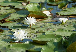
The sights and sounds of nature are around every turn with basking turtles, fish of all sizes arching out of the water for insects, the boom of bullfrogs, and whirl of bird wings. A myriad of wildlife is part of this water journey for paddlers of all skill levels as egrets, herons, ducks, hawks, kestrels, swallows, raccoons, rabbits, deer, bobcat, and many other aquatic and forest creatures debut their appearance for the thoughtful paddle trail enthusiast. The journey ends at the Loop 12 Boat Ramp and Trinity Trails Phase I.
The City that has long turned its back on the river is returning to it with a fresh, exuberant and sustainable outlook toward urban living.

